Accessing recently drilled petroleum well summary information
Summary information on recently drilled petroleum wells is available through the Geodata Catalogue Map and the Geodata Catalogue on the New Zealand Petroleum and Minerals (NZPAM) website.
If this is your first time using the Geodata Catalogue, please review the Terms of Use before accessing it.
You can access the information:
- through the Geodata Catalogue Map
- using the NZPAM web service if using a desktop GIS application, such as ArcGIS pro or MapInfo.
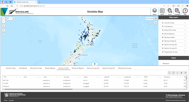
Using Geodata Map
The Geodata Catalogue Map can be accessed through the link on the welcome page of the Geodata Catalogue.

Click on the black arrow at the bottom of the window and then select the 'Petroleum Wells' tab. This will give you a listing of all the petroleum wells, including ones that have been recently drilled.
Scroll to the right of the table and sort on the 'Open File' column. The recently drilled wells have a 'No' status. Ctrl+click to select the rows/wells that you want.
This listing can be downloaded using the “Actions” Button on the right, choosing either to export all or selected data.
Using the NZPAM web service
If using a desktop GIS application like ArcGIS Pro or MapInfo, you can access a live data stream of the petroleum wells point data and summary information (along with other GIS data) through NZPAM's web service.
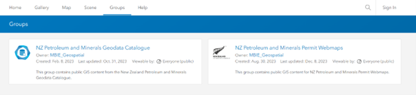
Select the “NZ Petroleum and Minerals Geodata Catalogue” This will take you to a page where you can select what web service you require.
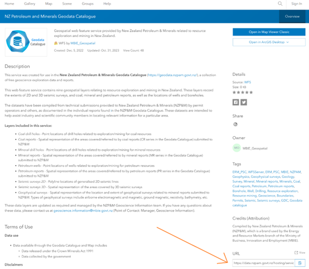
To access WMS and WFS services, as well as ESRI feature layers and map image layers, open the corresponding portal item for the WMS, WFS, or feature layer and scroll down to the ‘URL’ section of the webpage. Copy this URL into the application that you would like to consume the WMS, WFS, or feature layer in.
More information on how to use the web services can be found below.